The Talysh Mountains by 4x4: planning a southern Azerbaijan route
how-to · 8 min read
Plan a Talysh Mountains 4x4 route around Lankaran, Lerik and the southern forest landscape. Compare paved approaches with optional tracks, walking visits and a supported expedition, and ask for dated road, access, vehicle and recovery confirmation before booking.
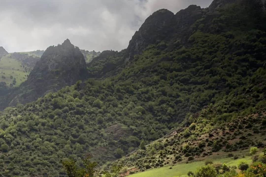

The Talysh Mountains offer a southern Azerbaijan route around Lankaran, Lerik and the forest landscape. For a private or agency expedition brief, distinguish the paved approach, any proposed unpaved tracks and walking visits. A dated proposal should identify the route, vehicle, guide, recovery provision and access checks rather than promise that every track is open.
Is the Talysh region an alternative to the northern circuit?
It is a different route choice, with a Lankaran base and southern mountain or forest visits instead of the Sheki, Gabala or Quba circuit. Compare the driving days, accommodation and activities against the time you have; do not choose it on a claim that there are no other visitors or tour operators.
The Azerbaijan Tourism Board's Sim village page, checked on 27 September 2026, explicitly describes hiking tours in the Hirkan forest landscape. That is evidence of visitor activities in the region, not proof that a particular forest track is legal or suitable for vehicles. Walking routes and motorised routes need separate confirmation.
What is the route, practically?
Base on Lankaran, 270 km from Baku on good highway through the coastal lowlands. The mountain day starts on the paved 55 km road up to Lerik, winding through gorge and forest. Beyond the town the surface ends and the real driving begins on clay forest tracks.
Those tracks run to the Qelebin waterfall, which drops 20 to 30 m through dense beech woodland, then along the ridge route to Kalakhan, a fortress village strung across a crest with views over stacked Talysh ranges, passing the Bibiyani heights on the way.
On our 8-day expedition this is days 2 and 3: roughly 60 km of track across the two days, rated easy on the Hirkan approach and moderate in the Lerik ridge country, with the details in the routes index. Lankaran is also a spa town in its own right, and crews with a rest day usually spend it at the Masalli thermal springs rather than driving further.
What does the public record say about the road?
A historical works notice is not a departure-day road report. Ask the proposal to identify the paved approach, each proposed track, the date-specific road and weather check and the alternative if a section is unsuitable.
For an expedition, confirm the support vehicle, recovery equipment, communications and operating roles against the exact itinerary and group size. These belong in the agreed scope rather than a universal rule inferred from the destination.
Is it worth flying to Lankaran?
For this 4x4 programme, plan the road. Lankaran has an airport, LLK, but the Baku airport departures board checked on 23 September 2026 showed no Lankaran flight. That one-day check does not prove no service will ever operate; confirm any proposed flight with the carrier for the actual date before putting it in an itinerary.
The arithmetic still favours the road for a driving trip. It is 270 km of highway, the vehicle has to get south anyway, and the coastal lowland run through the tea country is part of what the day is for. For a late joiner, quote a separate road transfer to meet the convoy rather than promise an unconfirmed domestic flight.
What does the clay actually demand?
The Talysh drives on forest clay, and clay has two personalities. Dry, the tracks are simple: pick a line through the ruts, mind the roots, first and second gear scenery driving. Wet, the same tracks grease over, ruts fill with standing water of unknown depth, and grades a stock SUV strolled up a week earlier become winch conversations.
Fog and reduced visibility can affect a mountain day. Agree the driving schedule, conditions for changing the plan and an alternative with the operating team.
Assess recent rain as well as the forecast before committing to an unpaved route. Do not enter an unassessed water crossing; follow the operating team’s route decision. Plan the mountain driving and return timing around visibility and conditions; the driving guide covers the wider road-trip brief.
On fuel, the south has one quiet advantage: prices are set nationally by the Tariff Council rather than station by station, so a litre in Lerik costs what a litre in Baku costs. Since 1 January 2026 that is 1.15 manat for AI-92 and 1.10 for diesel. What changes in the far south is pump spacing, not price, which is why we fill in Lankaran before the mountain day instead of counting on the next station.
What about the Hirkan forests?
The Hirkan woodland is the region's other headline: a relict subtropical forest older than the last ice age, protected as a national park. The honest driving answer is that you do not drive it. The park proper is for walking, and vehicles keep to the approach roads and the forest-edge tracks.
The practical version is the run to Xanbulan, a still lake wrapped in Hirkan woodland on the park's fringe, which is how our day 2 touches the forest before the climb to Lerik. Any operator promising to drive you through the national park itself deserves a second question.
What does the Iranian frontier mean for routing?
This guide describes a southern Azerbaijan programme, not a confirmed international crossing. For any cross-border extension, check each traveller’s passport, trip purpose, direction, crossing and vehicle with the relevant authorities before committing to the itinerary. Road and rail permissions are separate; the entry and rail guide records the dated official sources and their scope.
Where does this fit in a bigger trip?
The Talysh works two ways: as the opening act of the full 8-day crossing, warming crews up on forgiving clay before the high Caucasus days, or as a standalone 2 to 3 day loop from Baku for drivers who want a southern route without the full expedition. Both shapes run on the same spine: Lankaran base, Lerik mountain day, Xanbulan forest leg.
Season shapes the choice. Spring runs the waterfalls hard and the clay soft; the country-wide autumn window of early September to late October gives drier tracks, clearer ridgelines and the version of the region we would put a first-time crew in.
What we would not recommend
Before booking, confirm the actual route and operating scope:
- A wet-week ridge day in an unconfirmed hire car. Before using the Kalakhan or Bibiyani tracks, ask the rental company to confirm the exact route, permitted surfaces, tyres, underbody, roadside assistance and recovery terms in writing. Do not infer permission from the vehicle class.
- Treating historical information as a road-status check. Confirm the selected route for the departure date and agree a practical alternative.
- Adding an international crossing without confirmation. Resolve the route-specific entry and exit requirements before pricing a cross-border extension.
- Entry and permissions. BIRTOUR checks the itinerary requirements against the responsible official sources. Confirm the passport, trip purpose, direction and required permissions before booking a cross-border leg; final admission and authorisation decisions remain with the authorities.
For the full-route version, the 8-day expedition itinerary has the day tables, and net rates by group size are published. For operators building a southern extension into an existing Azerbaijan program, the 4x4 hub covers the white-label format. For a private or agency southern programme, send your dates, party size and driving preferences. BIRTOUR can prepare the route, hotels, transport, guiding, activities and expedition support in one proposal.
- Where are the Talysh Mountains and how do you get there?
- The Talysh range runs along Azerbaijan's far south near the Iranian border, behind the coastal city of Lankaran, about 270 km from Baku on good highway. The mountain gateway is the paved 55 km road from Lankaran up to Lerik; the driving country is the unpaved forest and ridge tracks beyond it. Lankaran has an airport, but the 23 September 2026 Baku departure-board check did not establish a scheduled flight. Confirm any proposed service with the carrier for your exact date; plan a road transfer until then.
- Do you need a 4x4 in the Talysh Mountains?
- The paved approach and an off-road expedition are different plans. Choose the vehicle after confirming the actual route, surface, weather, rental permissions and recovery provision. A 4x4 badge alone does not establish access or suitability for a track.
- What condition is the Lankaran to Lerik road in?
- This guide does not establish current road condition. Confirm the paved approach and any proposed track for the actual departure date, including weather, vehicle suitability, permitted access and an alternative route. Historical road works and a landscape photo do not confirm that a road is open.
- What is there to see driving the Talysh?
- Subtropical tea country and the Hirkan forests on the approach, the still lake at Xanbulan, Lerik town with its Museum of Longevity, the Qelebin waterfall cascading 20 to 30 m through beech forest, and Kalakhan, a ridge-top village with an old fortress site and views across successive ranges.
- Can you drive into Hirkan National Park?
- Not through it: the park proper is a protected relict forest and vehicles keep to approach roads and edge tracks. The practical version is the forest run to Xanbulan lake on the park's fringe, which is how our expedition touches the Hirkan woodland, followed by walking under the canopy rather than driving it.
- Can you cross into Iran from the Talysh Mountains?
- Do not treat this itinerary as confirmation of an international crossing. Check the exact crossing, passport, purpose, direction and vehicle with the relevant authorities before offering an extension. Road and rail permissions have separate conditions.
- When is the best season for the Talysh tracks?
- May to October, with the same clay caveat throughout: a dry week makes every track easy, a wet one closes the steep sections to anything without four-wheel drive and patience. Spring runs the waterfalls at full flow; September and October give the driest tracks and the clearest ridgelines, and they sit inside Azerbaijan's country-wide autumn window of early September to late October.
- Are there tours in the Talysh Mountains?
- Yes. Azerbaijan Tourism Board promotes hiking tours around Sim village in the Hirkan forest landscape. A walking tour is different from a supported 4x4 expedition: compare the actual route, transport, guide, access conditions, recovery provision and inclusions. Birtour can prepare a supported itinerary for your group and travel dates.
Destination
Lerik: the Talysh Mountains' longevity town and its forest tracks
Guide
Azerbaijan 4x4 routes: an index of tracks, seasons and difficulty
Guide
Driving in Azerbaijan: licence checks, fuel, borders and route choice
Guide
Lankaran and Masalli Thermal Springs: Azerbaijan's Southern Balneology (2026)
Itinerary
Azerbaijan 4x4 self-drive expedition: 8 days, Talysh to Greater Caucasus
Pricing
4x4 self-drive expedition in Azerbaijan: net rates by group size